
Archaeology
Monastic site founded by St Moulag discovered on Scottish island
Archaeologists from the Lismore Historical Society have announced the discovery of a stone built monastic site on the Hebridean Isle of Lismore.
According to the researchers, the site dates from the 7th to 10th century AD and was likely founded by St Moluag, an Irish missionary who evangelized the Picts on the western seaboard of Scotland.
Lismore had long been an important religious centre for the Gaelic kingdom of Dalriada, which likely motivated the decision to found a monastic community in AD 562. Irish missionaries had learnt to focus heavily on the similarity and continuity between early Christianity and Paganism rather than the differences between them.
However, according to tradition, the rock on which Moluag stood detached itself from the Irish coast and he drifted across to the island of the Lyn of Lorn in Argyll, now called the Isle of Lismore in Loch Linnhe.
Following a six year community led project on the island, members from the Lismore Historical Society have uncovered an oval stone building and a workshop where craft workers manufactured jewellery from precious metals.
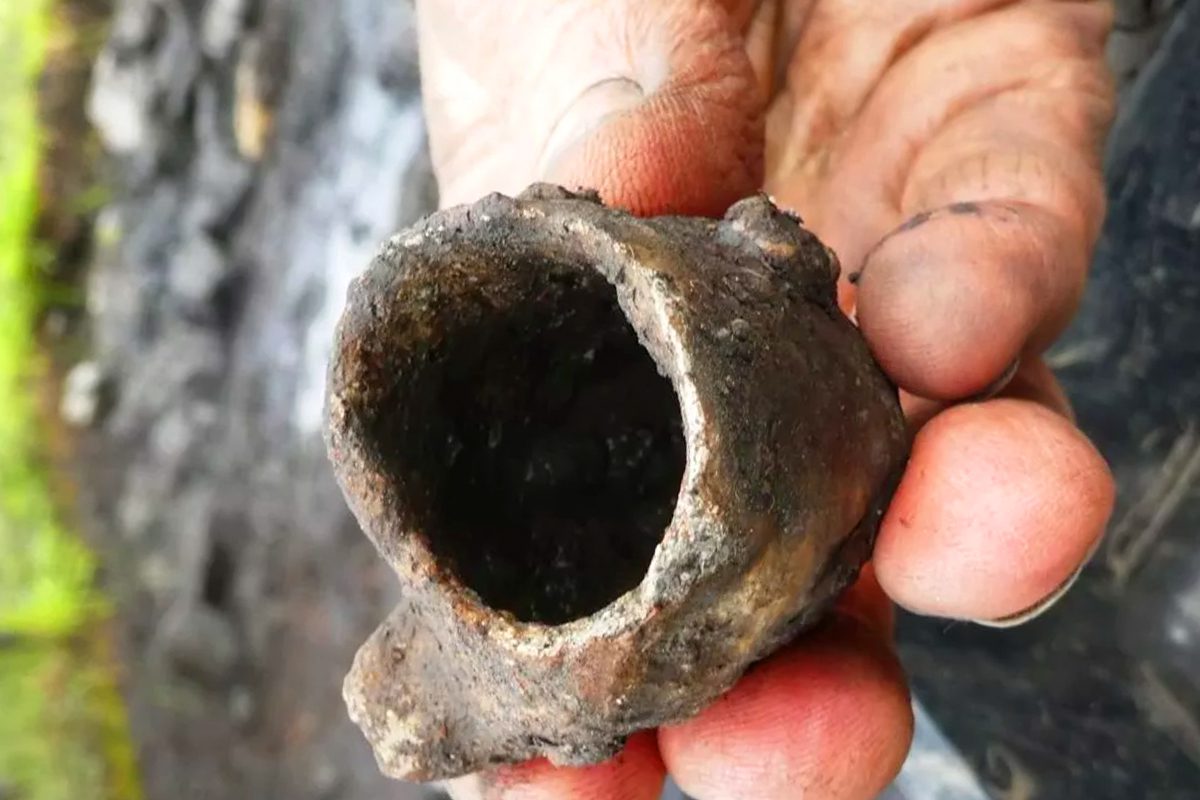
Part of a crucible – Image Credit : Lismore Historical Society
Radiocarbon dating has placed the building to the 7th-10th century AD during the period of the early monastery.
The study has so far discovered fragments of around 120 crucibles, broken ceramic moulds for making penannular brooches, and carvings made in stone, wood, bone and antler.
According to a press statement by the Lismore Historical Society: “XRF analysis of the surfaces of these crucibles at the National Museum of Scotland has revealed that they were used for melting copper-alloys, silver and gold.
This fine craft activity is evidence of a sophisticated and influential monastic centre, the society said, with analysis and conservation of 1500 significant finds from the site ongoing.
Header Image Credit : Lismore Historical Society
Sources : Lismore Historical Society
This content was originally published on www.heritagedaily.com – © 2023 – HeritageDaily
Archaeologists from Oxford Archaeology have uncovered a well-preserved Bronze Age wooden well in Oxfordshire, England.
The discovery was made during construction works for the Benson Relief Road in compliance with planning conditions to ensure archaeological finds are recorded.
John Boothroyd, Senior Project Manager at Oxford Archaeology, said: “When investigating what appeared to be a standard pit for the site, the archaeological team started exposing the remains of a preserved wooden post driven vertically into the ground.”
Excavations revealed that the posts formed the uprights of a wattle structure lining the edge of the pit, which have been well-preserved due to the soil conditions being waterlogged.
The timber structure was digitally recorded, before being carefully dismantled by hand for removal to the Oxfordshire Museum Service.
Samples of the preserved wood have been sent for further analysis to indicate the type of wood used in the construction. Excavations also found pieces of struck flint, animal bone and pottery used for storage and waste.
Previous studies of the area around Benson and as far as Wallingford have revealed traces of Bronze Age activity and settlement.
“Despite the extremely challenging conditions, the team were able to expose and fully record the well. The specialist soil samples collected will also help establish what the surrounding landscape would have been like, and the intensity to which it was settled, when the well was actively being used.”
Councillor Judy Roberts, Oxfordshire County Council’s Cabinet Member for Infrastructure and Development Strategy, said: “This find gives fantastic insight into the area’s past land use. It is thought the well may have been used for agricultural irrigation purposes for settlements nearby. Archaeological surveys like this are an important part of the process of delivering construction schemes. They help us identify and understand past residents of the area and record them for future generations.”
Header Image Credit : Oxford Archaeology
Sources : Oxfordshire County Council
This content was originally published on www.heritagedaily.com – © 2023 – HeritageDaily
A restoration project to remove invasive plants from dunes in the Heist Willemspark, Belgium, has led to the discovery of three intact WWII bunkers.
Heist Willemspark is located in the Knokke-Heist municipality, situated on the coastline of Belgium near the border with the Netherlands.
During WWI, the area of the park was used as a German position for heavy artillery batteries known as “Freya” and “Augusta”, and a series of forward observation bunkers for ranging shipping in the English Channel.
A number of these structures were repurposed by the German army in WWII, and further fortified as part of the Atlantic Wall, a system of coastal defences built between 1942 and 1944 along the coast of continental Europe. The area of the Atlantic Wall at Heist Willemspark was designated by the German army as Stützpunkt Heyst.
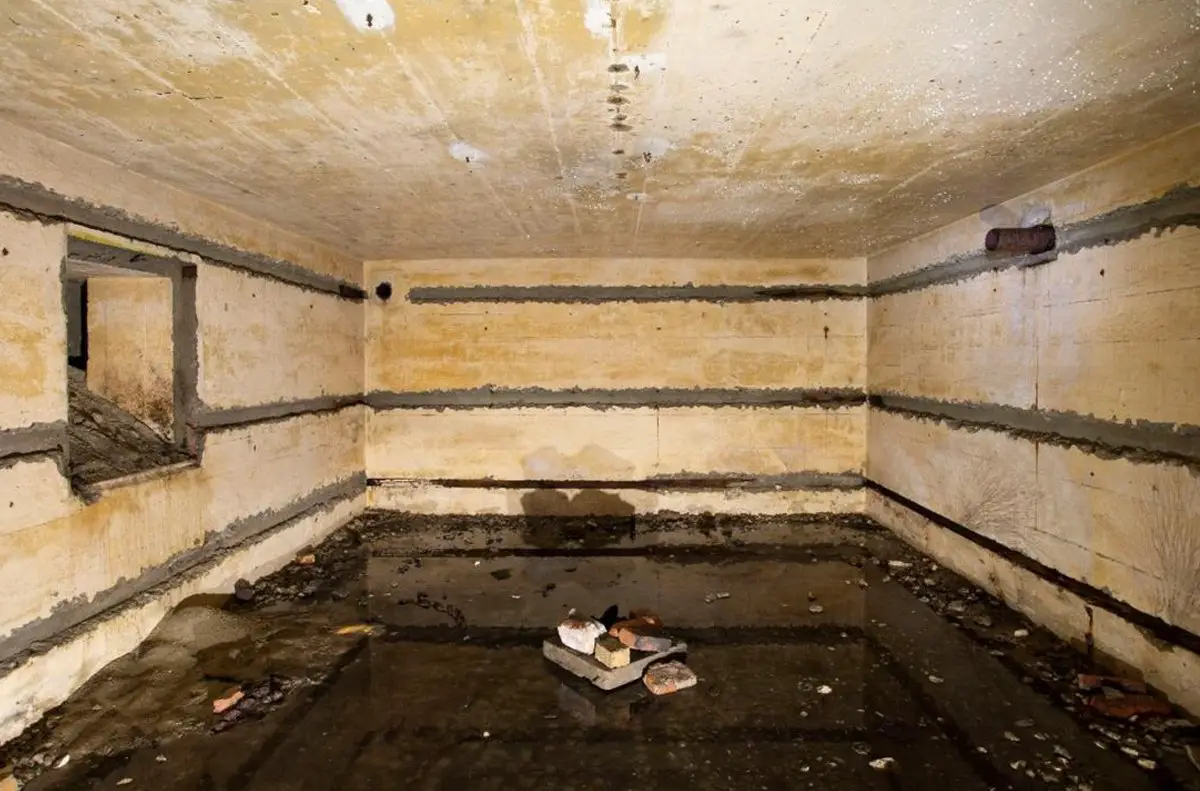
Image Credit : Municipality of Knokke-Heist
According to a press statement by the Municipality of Knokke-Heist, the bunkers were discovered by the Agency for Nature and Forests during a restoration project called LIFE DUNIAS.
Excavations at a depth of only a few feet revealed three Gruppenunterstand Type VF2a bunkers. The VF2a is intended for housing a Gruppe (the smallest German unit consisting of 10 soldiers) who operated forward radar positions. The bunkers at Heist Willemspark measure 6 by 7 metres externally, and are capped by a concrete reinforced roof measuring 1 metre thick.
The project also found traces of brick trenches, a fragment of a concrete track, and large amounts of rubble containing objects such as utensils, ammunition, cabling, and water pipes.
A representative of LIFE DUNIAS said: “These ruins illustrate the previous attempts to completely erase the park’s war history. The lighter structures were demolished and reduced to rubble, while heavier bunkers were covered with a layer of soil and hidden, as if they had never existed.”
Header Image Credit : Municipality of Knokke-Heist
Sources : Municipality of Knokke-Heist
This content was originally published on www.heritagedaily.com – © 2023 – HeritageDaily
-
 Ghosts2 years ago
Zozo: The Ouija Board Demon
-
 Space2 years ago
Scientists claim to have found the answer what existed before the Universe
-
 Ghosts2 years ago
Old Coot of Mount Greylock
-
Archaeology1 year ago
New discoveries at Ekʼ Balam during conservation works
-
 General3 years ago
UC San Francisco engaging in horrifying experiments, organ harvesting of live babies in the name of “science”